The Wentviska Sea is a fictional sea of the fictional continent of Aels.
The Wentviska Sea is connected to the Atlantic Ocean, surrounded by the Wentviska region and almost completely enclosed by land: on the north by Nebel Region, on the south by Nutkia Grasslands, in west by The Colossal and on the east by the Barnopean Archipielago. The sea is technically a part of the Atlantic Ocean, although it is usually identified as a completely separate body of water.
The name Wentviska is derived from the Spanish ventisca, meaning "Blizzard" due the winds that dominate for most of the year this inner sea.
It covers an approximate area of 2.99 million km² (Extended Earth).
The Wentviska Sea has an average depth of 1,500 metres and the deepest recorded point is 5.500 metres in the Hogaza Deep in the eastern Wentviska Sea.
It was an important route for aelian merchants and travelers of ancient times that allowed for trade and cultural exchange between emergent peoples of the region — the Bazik, Krakavian, Nutk, German-Aelian, The Colossal, Ravinian amd Wentvlish cultures. The history of the Wentviska region is crucial to understanding the origins and development of many of the Aelian societies.
History[]
As a sea around which some of the most ancient Aelain civilizations were arranged, it has had a major influence on the history and ways of l
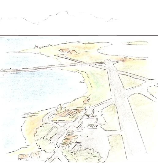
Verbal airport, Schiavolo
ife of these cultures. It provided a way of trade, colonization and war, and was the basis of life (via fishing and the gathering of other seafood) for numerous communities throughout the ages.
The combination of geology and access to a common sea (between other factors) has led to numerous historical and cultural connections between the ancient and modern societies around the Wentviska.
Geography[]
The Wentviska Sea is connected to the Wikipedia: Atlantic Ocean by the Stratit of the Kings in the north-east and the Delanen Strait in the south-east.
The man-made Triad Canal in the west connects the Wentviska Sea to the Karkaz lake and the Grüne SeeGrüne See.
Large islands in the Wentviska include Barnopea, Hellland, Spelling, Sandbar,Ayuyel, Delanen,Marraqueta,Abbidoland,Werland,King's Island,Beriel, Kiefel,Stiel,Narrket,Artail and Telmopán
The Climate of the region change, as in the north shores is template, as well in the Barnopean archipielago, meanwhile in the South shores is subtropical.
Oceanography[]
Being nearly landlocked affects the Wentviska Sea's properties; for instance, tides are very limited as a result of the narrow connection with the Atlantic Ocean. The Wentviska is characterized and immediately recognized by its dark blue color.
Is said that the encounter of cold and a warm waters create the mists and rains, almost permanent for most of the year, of the Nebel See in the north of the Wentviska.
Bordering countries[]
Nine modern states have a coastline on the Mediterranean Sea. They are: (from west to East)
The Colossal,Puro Pan Republik,Beostan, Great Grammar and Spelling, Krakavia, Arvenia, Deliverence,Brno and Barnopea.
Some of the capital cities of sovereign countries and major cities with large populations people bordering the Wentviska Sea are: Cydonia, Neublin, Abendburg, Nieman, Gabolinchenstadt, Telmopán, Yumando, Dremen, Marsherren, Harraskar, Humburg, Hellwighausen, Kryngrad, Samaelskoia, Kalinka, Dlod, Hyar, Drogul, Praan, Ortograph, Miroca, Verbiage, Celias, Quaros, New Westford, Besil, New Dublin, New London, Rapture, Werland, Hikast, Hällback, Nadensburg, Coralax, Isstvan, Rizza, New Nadensburg, Vinhoffen, Chelnyabirsk, Grudgelskyvadar, Verbal, Adjective, Baralee, Tuddbaeth and Beosend
Subdivisions[]
The Wentviska Sea is subdivided into a number of smaller waterbodies, each with their own designation (from west to east):
- the Colossal Sea, between The Colossal and Abbidoland;
- the Zentro Sea, between Abbidoland and Marraqueta Islands;
- the Nebel See, between Great Grammar and Spelling and the Hellland Archipielago.
- the Straits of the Kings, between Brno and Barnopea
- the Barnopean Sea enclosed by Barnopea, 'Marraqueta Islands and Nutkia'
- the Delanen Straits, Between Barnopea and Adanea